Alone with the river
In the most densely populated state in the nation, the Delaware was ours for the day

We had avoided the faintly blazed, indifferently cleared, ridiculously steep Pioneer Trail for a long time. Then one day, a closed gate at the Delaware Water Gap National Recreation Area (DWGNRA) blocked us from our preferred trail, so we pulled into the parking lot at Millbrook Village in New Jersey to consider an alternative. Why, I wondered, did these nineteenth-century houses look so eerie? I am unused to looking at simple, freestanding houses without electrical lines, phone boxes, or water mains. Just chimneys and a woodshed out back.
A little wooden sign with peach lettering across the street caught my eye. The Orchard Trail. I know that trail. Sure, it looks all nice and inviting, but it exists mostly to get you to the Pioneer Trail, which, as I mentioned, is not the nicest! Still, it leads to the banks of the Middle Delaware, and it’s one of the few foot trails, outside of the McDade on the Pennsylvania side, that does.
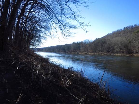
Suddenly I was smitten with an urge to have our picnic by the cold, slate-colored river. I wanted to sit on the frozen bank and the watch ducks fly in that way they do, in tight formation a foot above the water. I wanted to smell the river’s February smells.
But the Pioneer Trail! Painful memories flooded in. In one recollection, I sit down, prop myself against a tree, and tell Tom I’ve given up, and that he may settle my estate in any way he likes.
Today we ended up overruling our better judgment, to find that much had changed. The trail was firm, without the soft duff I once sunk into mid-calf. The little orange blazes were plentiful, so we didn’t go sideways. The thorny bushes that once snagged our jackets – and this riverine environment has so very many kinds of thorny bushes! – had been cleared from the trail. The experience was akin to driving a freshly paved road that had once been almost impassable; it felt like flying. I could only imagine, with profound gratitude, the work that went into this transformation.
The way down to the river is still steep, of course. It takes you through a variety of landscapes, from the lovely meadows of Millbrook, down into a piney wood, down further into sycamores and river birches nearly dwarfed by the muscular vines coiled around their trunks – Virginia creeper, poison ivy, wild grape, bittersweet, climbing hydrangea. On earlier trips, I’d taken many artsy photos of an off-trail abandoned farmhouse close to the river. Leafy vines curled charmingly through its gabled windows, and maidenhead fern crowned its eaves. It was half house, half plant. Tom even did a wood-burning sketch of the place. But it was gone. I couldn’t even tell which of the overgrown fields once contained it. We notice, with every trip to the DWGNRA, the slow-motion death of its historic structures. Another window broken, another roof collapsed, as neglect and vandals demolish them by inches. The Pioneer gladdens and saddens us today.
We cross under pylons carrying transmission lines across the river. Soon after that, we take a spur trail leading to the water. There were ducks, lots of them, pumping above kayak-less water. And there was the ever-traveling current, and the metallic smell I craved. To get out of the wind, we settled on the bottom of a draw that funnels rain and snowmelt into the river. To the left, hugging the water’s edge, is another foot trail, unmarked, that leads to a string of campsites, Depew Island, and eventually away from the river to the Old Mine Road.
The easy-walking Hamilton Trail creates a loop that returns you to the Orchard Trail and Millbrook Village. It’s not obviously steep. But since what goes down must come up again, we expected a long, gradual, relentless climb, and we got it.
Soon, the river will fill up again with boats and anglers and whoops of laughter. But we didn’t see another soul. Here, in the most densely populated state in the nation, in one of the most popular recreation areas in the region, we had, for one winter’s day, our very own park.
SNEAK PEAK
Trailhead: Old Mine Road at Millbrook Village, Delaware Water Gap National Recreation Area
Trails: Hike the Orchard Trail for 0.55 miles, turn left onto the Hamilton Ridge Trail for 0.7 miles, turn right onto the Pioneer Trail for 2.35 miles (with another right on the quarter-mile spur trail that leads to the river), turn left onto the Hamilton Ridge Trail, then turn right onto the Orchard Trail for another 0.55 miles.